REGISTERED LAND SURVEYOR — NSW
Registered Land Surveyors & Planning Consultants servicing Wagga Wagga, Albury-Wodonga and the Riverina
Riverina Surveying & Consulting provides precise cadastral surveying, subdivision advice, planning support and spatial data solutions for landowners, developers and professionals across the Riverina and regional NSW.
Led by a Registered Land Surveyor, delivering precise, compliant, and dependable surveying and consultancy services
Our Approach
Surveying Precision. Development Insight. Regional Knowledge.
We provide reliable land information that informs development decisions. From understanding property constraints and subdivision potential to identifying planning pathways and managing project risk, our surveying and consultancy support is built on decades of regional expertise and professional standards.
Core Services
Comprehensive Land Surveying & Consultancy
Cadastral Surveys
Precise boundary, subdivision and title-related surveys for property owners, developers and legal professionals.
Strata, Community, Neighbourhood & Stratum Surveys
Survey plans for strata, community, neighbourhood and stratum developments, supporting approvals and land registration.
Detail, Engineering & Construction Setout Surveys
Accurate site surveys, engineering survey support and construction setout for planning, design and building works.
Town Planning & DA Support
Planning and development application support tailored to the complexity of your subdivision or development proposal.
Drone & Spatial Data
Authorised drone pilot services for aerial imagery, drone mapping, site analysis and spatial data capture.
Why Choose Us
The Riverina Surveying Difference
Registered Surveying Expertise
Led by a Registered Land Surveyor with deep professional knowledge and credentials.
Development-Focused Advice
We understand development pathways and provide practical guidance beyond surveying.
Clear Communication
Complex surveying and planning concepts explained clearly to all stakeholders.
Regional NSW Knowledge
Deep familiarity with regional markets, councils, and local development patterns.
Accurate Land Information
Reliable data and documentation that supports confident decision-making.
Professional Documentation
Comprehensive reports and plans that meet regulatory and professional standards.
Who We Work With
Serving Regional NSW Professionals
We partner with property professionals, developers, builders, architects, planners, legal professionals, and local government across regional NSW to deliver comprehensive surveying and consultancy solutions.
Service Areas
Serving Regional NSW
Based in the Riverina, we provide surveying and consultancy services throughout regional NSW, including Wagga Wagga, Albury-Wodonga, the Riverina and NSW/VIC border areas.
View All Service Areas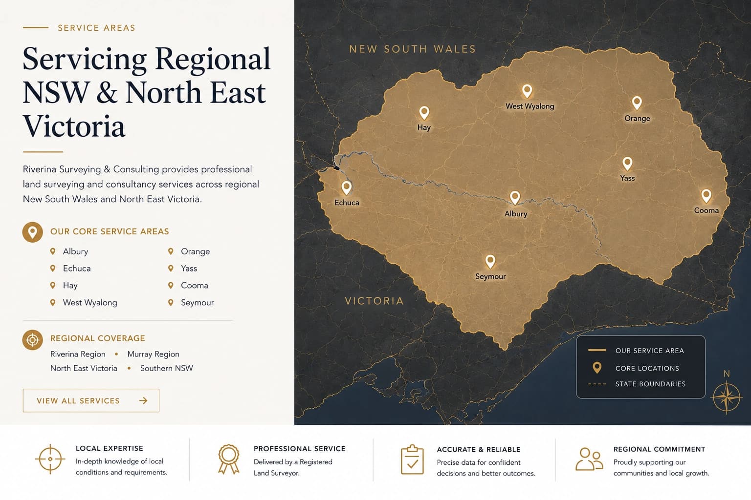
Planning a subdivision, boundary survey or property development?
Early input from a surveyor and development consultant can identify opportunities and manage risk. We're here to help guide your project from initial feasibility through to completion.
Contact Riverina Surveying & Consulting